Agricultural Drone Services — NDVI Mapping and Precision Spraying
Drone services for agriculture and viticulture in Burgundy: NDVI mapping, certified phytosanitary spraying and biocontrol. Nièvre, Côte-d'Or, Saône-et-Loire.
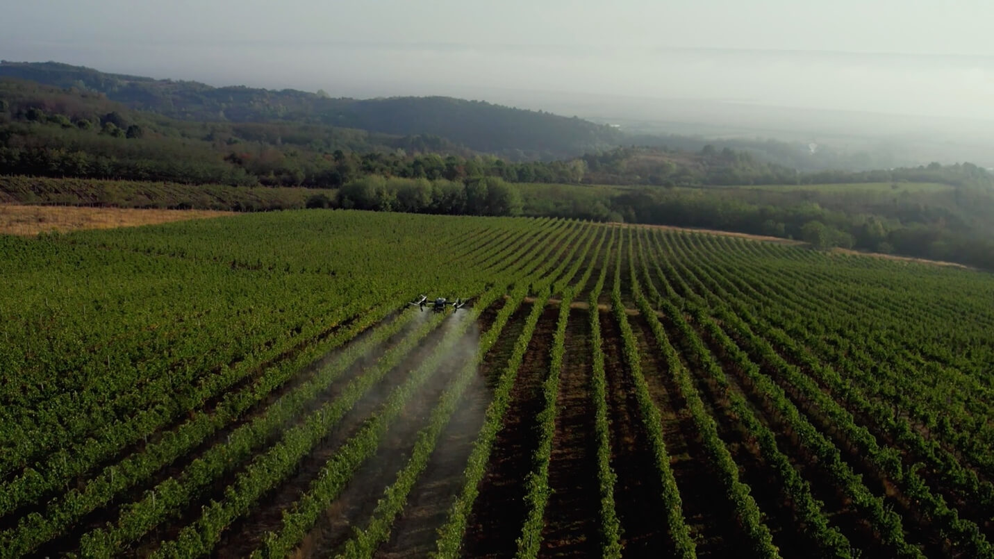
The DJI Agras T100 is the benchmark tool for precision agriculture: capable of spraying up to 10 L/min with anti-drift nozzles, it complements multispectral NDVI mapping to target interventions to the nearest metre. Combined with our certiphyto certification and certiBiocide accreditation for biocontrol products, we support farmers and Burgundy winegrowers towards more efficient and sustainable farming.
Why use drones in agriculture?
Facing growing pressure to reduce inputs and tighten environmental regulations, drones offer a concrete response:
- Reduced inputs: precision treatment targets only areas that need it, cutting product volumes by 20–40%
- Access to difficult plots: steep vineyard slopes, waterlogged areas, proximity of hedgerows or watercourses
- Speed: up to 10 hectares treated per hour depending on the crop
- Regulatory traceability: timestamped flight logs, volumes applied per zone, compliant with DGAC and phytosanitary requirements
Concrete applications
NDVI mapping and crop health monitoring
The multispectral sensor measures the vegetation index (NDVI) to detect water stress, mineral deficiencies or pest attacks before they are visible to the naked eye. Vigour maps guide variable-rate input applications plot by plot.
Certified phytosanitary spraying
Treatment of vines, arable crops and orchards with UAV-approved products. Our certiphyto certification (operator) ensures compliance with doses, no-spray zones and regulatory weather conditions.
Biocontrol and pesticide alternatives
Thanks to our certiBiocide accreditation, we carry out applications of biocontrol products (natural agents, micro-organisms, pheromones) in line with France's Ecophyto plan — an effective alternative for organic or integrated farming operations.
Plot surveys and plant counting
Vine plant counting after frost or hail, planting layout mapping, arable crop emergence monitoring: the drone delivers accurate data in a few hours where a ground-based inventory would take several days.
Who is it for?
- Winegrowers in Côte-d'Or (Beaune, Nuits-Saint-Georges) and Saône-et-Loire (Mâcon, Mercurey)
- Arable farmers in Nièvre and Cher: wheat, maize, oilseed rape, sunflower
- Agricultural cooperatives seeking pooled solutions for their members
- Market gardeners and fruit growers aiming to reduce tractor passes and protect soil structure
- Organic or HVE (High Environmental Value) farms
When to intervene?
- Spraying: early morning (ideally before 9 am), wind below 5 m/s, temperature 5–25 °C, no frost
- NDVI mapping: at key growth stages (flowering, fruit set, véraison for vines), on clear days
- Plant counting: after weather events (frost, hail, drought) or at the start of the season to plan fieldwork
Service area
We operate in Nièvre (58) and neighbouring departments: Yonne (89), Côte-d'Or (21), Saône-et-Loire (71), Allier (03), Cher (18) and Loiret (45).